India's No.1 PU & Degree With Integrated IAS & IPS(UPSC/PSC) Training College.

NavIC Revival: ISRO Boosts India’s Navigation
NAVIC REVIVAL: ISRO STRENGTHENS INDIA’S INDIGENOUS NAVIGATION SYSTEM
WHY IN THE NEWS ?
- Upcoming Launch: ISRO is scheduled to launch NVS-03, the third-generation navigation satellite, to restore India’s Navigation with Indian Constellation (NavIC).
- Strategic Importance: The satellite aims to strengthen India’s independent satellite-based positioning system following failures of atomic clocks and previous satellite launches.
NAVIC: INDIA’S INDIGENOUS NAVIGATION SYSTEM
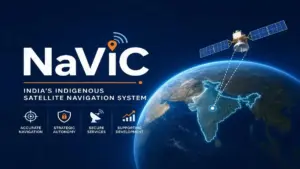
- Full Form: NavIC stands for Navigation with Indian Constellation, earlier known as the Indian Regional Navigation Satellite System (IRNSS).
- Regional Coverage: It is designed to cover the Indian subcontinent and an area extending approximately 1,500 km beyond India’s boundaries.
- Satellite Constellation: The original system was designed around seven satellites to provide continuous regional navigation services.
- Positioning Accuracy: NavIC was designed to provide public positioning accuracy of approximately 10 metres, alongside a restricted service for authorised users, including defence agencies.
- Strategic Advantage: It provides better coverage over Indian territory, particularly in valleys and forests, compared with GPS signals received at certain angles.
- Global Comparison: The four major global navigation systems are America’s GPS, Russia’s GLONASS, Europe’s Galileo and China’s BeiDou.
SATELLITE FAILURES AND TECHNOLOGICAL IMPROVEMENTS
- Atomic Clock Failure: Several NavIC satellites became ineffective because of defective imported atomic clocks, which are essential for accurately calculating signal travel time.
- Mission Setbacks: Of the 11 navigation satellites launched since 2013, six experienced failures due to technical and orbital problems.
- Launch Failures: IRNSS-1H failed to reach orbit because its protective heat shield did not separate properly during launch.
- Orbital Problems: NVS-02 reached its transfer orbit successfully, but propulsion system failure prevented it from reaching its intended operational orbit.
- Indigenous Technology: Second-generation satellites, including NVS-01, incorporate indigenously developed atomic clocks with an intended mission life of 12 years.
- Improved Compatibility: The new generation supports the L1 frequency, alongside L5 and S-band signals, improving compatibility with GPS-enabled devices and wearable technologies.
KEY POINTS: SATELLITE NAVIGATION SYSTEMS● Working Principle: Satellite navigation systems determine location using signals transmitted by satellites and precise time measurements. ● Atomic Clocks: These highly accurate clocks calculate the time taken by signals to travel between satellites and receivers. ● ISRO: The Indian Space Research Organisation was established in 1969 and functions under the Department of Space. ● Strategic Applications: Navigation systems support defence operations, disaster management, transportation, agriculture, surveying and emergency response. ● Technological Sovereignty: Indigenous navigation infrastructure reduces dependence on foreign systems and strengthens India’s strategic autonomy and technological capabilities. |