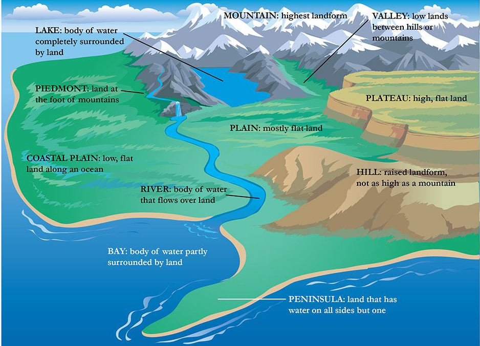
MAPPING: IMPORTANT LANDFORMS ACROSS THE WORLD
Asia Continent
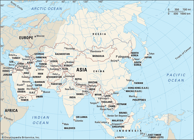
Asia, the world’s largest and most diverse continent, holds a unique position on Earth’s geographical and cultural map. This expansive landmass is not only distinguished by its size but also by the variety of cultures, languages, and natural landscapes it encompasses.
Geographic Boundaries and Location
- Northern Boundary: The Arctic Ocean marks the northern edge of Asia, setting a cold, expansive border that stretches across the top of the continent.
- Eastern Boundary: To the east, Asia is bounded by the Pacific Ocean, which separates it from the Americas and provides extensive coastline that influences the climate and economy of eastern Asian countries.
- Southern Boundary: The Indian Ocean lies to the south of Asia, serving as a crucial maritime route that has facilitated trade and cultural exchange between Asia and the rest of the world for centuries.
- Southwestern Boundary: The Red Sea and the inland seas of the Atlantic Ocean, namely the Mediterranean Sea and the Black Sea, demarcate Asia from Africa and Europe to the southwest. These bodies of water have historically been vital corridors for trade, migration, and cultural interchange.
- Western Boundary: Europe forms the western border of Asia, with the Ural Mountains, Ural River, Caspian Sea, and Caucasus Mountains often cited as the natural dividing lines between the two continents.
Political Geography
- Countries: Asia is composed of 48 countries, showcasing a remarkable range of political systems, economies, and cultures. From the vast expanses of Russia in the north to the island nations of Southeast Asia, the continent’s political landscape is as varied as its physical one.
- Areas of Special Sovereignty: Regions such as Taiwan, Hong Kong, and Macau hold unique political and administrative statuses. While not universally recognized as independent countries, these areas maintain distinct economic and legal systems, reflecting the complex nature of sovereignty and governance in Asia.
Natural Features
- Highest Elevation: Mount Everest, standing at an elevation of 8,848.86 meters (29,031.7 feet), is not only Asia’s highest point but also the highest peak in the world. Located in the Himalayas on the border between Nepal and China, it represents a symbol of natural wonder and a challenge for mountaineers.
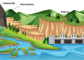
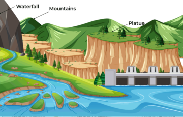
- Largest Watershed: The Ob River, extending across western Siberia, Russia, forms the largest watershed in Asia. It plays a crucial role in the region’s ecosystem and is vital for transportation, fishing, and industry.
- Largest Desert: The Gobi Desert, spanning parts of northern and northwestern China and southern Mongolia, is Asia’s largest desert. Known for its harsh climate and diverse ecosystems, the Gobi has been a significant historical landmark, notably as part of the Mongol Empire and the Silk Road route.
- Longest River: The Yangtze River, flowing for 3,915 miles (6,300 kilometers) across China, is the longest river in Asia and the third-longest in the world. It is central to China’s cultural history, economy, and agriculture, supporting millions of people along its banks.
UPSC PREVIOUS YEAR QUESTIONS
1. “Each day is more or less the same, the morning is clear and bright with a sea breeze; as the Sun climbs high in the sky, heat mounts up, dark clouds form, then rain comes with thunder and lightning. But the rain is soon over.”
Which of the following regions is described in the above passage?
(a) Savannah
(b) Equatorial
(c) Monsoon
(d) Mediterranean
2. Consider the following pairs: (2022)
| Peak | Mountains |
| 1. Namcha Barwa | Garhwal Himalaya |
| 2. Nanda Devi | Kumaon Himalaya |
| 3. Nokrek | Sikkim Himalaya |
Which of the pairs given above is/are correctly matched?
(a) 1 and 2
(b) 2 only
(c) 1 and 3
(d) 3 only
3. What are the environmental implications of the reclamation of water bodies into urban land use? Explain with examples.