India’s geospatial technology industry
Context: India’s geospatial technology industry was expected to cross ₹63,100 crore by 2025 at a growth rate of 12.8%.
About Geospatial Technology
- “Geo” is a Greek word meaning Earth and “Spatial” means relating to space. It can be defined as a technology used to collect, analyse, and store geographic information. It uses specially designed software to collect geographical locations while analyzing the impact of human activity.
- The data generated using geospatial technology is called geospatial data.
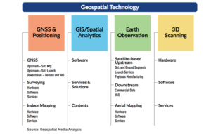
Some of the most common geospatial technologies include
- Remote Sensing
- Geospatial technology is used to study objects or surfaces at faraway distances using the images and data collected from space or airborne camera and sensor platforms.
2.Geographic Information Systems (GIS)
- It is a framework for gathering, managing, mapping, and analyzing the physical environment data of a specific location on the Earth’s surface.
- GIS uses layers of geographic data to produce spatial analysis and derivative maps or 3D scenes. With this unique capability, GIS reveals more in-depth insights into data, such as patterns, relationships, and situations—helping users make smarter decisions.
3. Global Positioning System (GPS)
- It is a navigation system using satellites, a receiver, and algorithms to synchronise location, velocity and time data for air, sea and land travel.
- The working of GPS is based on a mathematical technique called Trilateration. The technique suggests that GPS devices require three satellites for an accurate calculation of a position.
Application
- Climate Change and Disaster Management
- Enhance situational awareness and provide actionable intelligence for decision support in mitigating, preparing, and responding to natural disasters.
- Earth Observation Capabilities
- There is a wide range of processes that can be monitored using Earth observation data like vegetation biomass, phenology, water quality, land and sea surface temperature, ocean salinity, and many more.
- Healthcare
- During COVID-19 it helped the healthcare professionals in monitoring contact tracing, containment zones, disinfections, migrant support, and so on.
- Land and Forest Resource Management
- Create survey infrastructure of Indian villages
- Developing maps, and generating accurate land records for rural planning.
- Similarly, forest departments also use remote sensing and GIS technologies to map the forest cover and in carbon stock assessment.
- It also helps in detecting forest fires and deforestation.
- Transportation and logistics
- Identifying location and time of arrival, route making, and navigation of the consignments.
- Meteorology
- Geospatial technologies and tools help in weather forecasts of particular territories.
| Various source options and methods of geospatial technologies have been employed to generate images using the satellites revolving around our planet.
These include ● Filmed or digital aerial images from aeroplanes and drones ● Electromagnetic impulses (including visible, infrared, and microwave channels) ● Radio detection and Ranging (Radar) and Light Detection and Ranging (Lidar) to calculate the distance using radio or light signals. |
| Practice Question
|