CARTOSAT-2, WHICH AIDED URBAN PLANNING FOR OVER A DECADE, BROUGHT DOWN
Why in the news?
- After seventeen years since its launch, ISRO announces the deorbiting of Cartosat-2, the pioneering satellite of its second-generation high-resolution imaging satellites.
- The descent into Earth’s atmosphere occurred as predicted on February 14, 2024, leading to the disintegration of all its
 Source: Slideserve
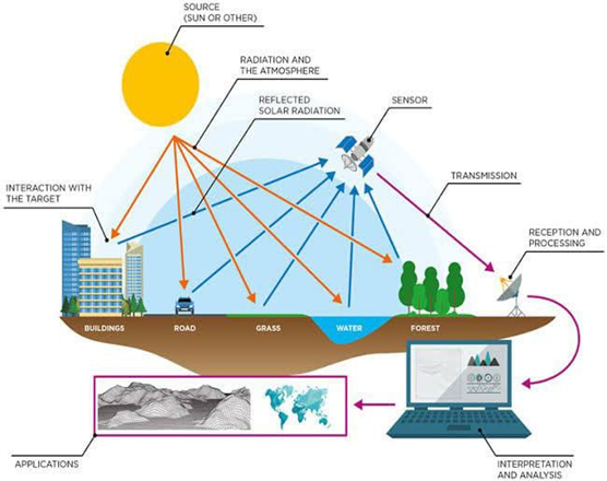
About Cartosat-2 satellite:
- Cartosat-2 launched on Jan 10, 2007, weighing 680 kg.
- Operated in a sun-synchronous polar orbit at 635 km altitude.
- Equipped with advanced cameras for high-resolution imaging until 2019.
| What is Remote sensing?
● Remote sensing gathers and analyzes data without direct physical contact. ● Applied in various fields like geography, hydrology, ecology, and geology Types of Remote sensing: ● Active remote sensing uses artificial radiation sources to probe targets. ● Passive remote sensing relies on solar radiation, observed in multispectral and hyperspectral sensors. |