SVAMITVA Scheme: A Citizen-Centric Global Model
SVAMITVA Scheme Recognised as Citizen-Centric Global Model
Why in the News ?
Dr. Jitendra Singh, Union Minister for Science & Technology, hailed the SVAMITVA Scheme as a global model for citizen-centric governance, highlighting its role in land self-mapping, international collaborations, and technological advancements during a high-level Survey of India meeting in New Delhi.
Achievements and Future Plans of SVAMITVA Scheme:
- Objective: Empower citizens to self-map land parcels, reducing dependency on traditional revenue systems.
- Minister’s Statement: Described as a global benchmark for governance, combining technology and citizen participation.
- Survey of India’s Role:
- Technical support to national missions such as AMRUT, Smart Cities, and NAKSHA.
- Driving the scheme’s nationwide implementation.
- Technological Upgrades:
- Planned integration of Artificial Intelligence (AI) and Machine Learning (ML) for advanced mapping.
- Target completion of high-resolution topographical mapping by 2030:
- Urban & Rural: 5–10 cm resolution.
- Forests & Wastelands: 50–100 cm resolution.
- National Workshop: Proposed to showcase transformation from map producers to geo-spatial enablers.
Impact on Governance and Technology Integration:
- Citizen Empowerment: Direct land parcel mapping by owners ensures transparency and ownership security.
- Administrative Efficiency: Minimises reliance on outdated revenue record systems, speeds up land dispute resolution.
- International Recognition: Positions India as a leader in geo-spatial governance solutions.
- Next Steps:
- Expand global partnerships.
- Integrate AI/ML for automated mapping and analysis.
- Complete national-scale high-resolution mapping by 2030.
- Minister’s Vision: “From traditional map-making to advanced geo-spatial enablers, Survey of India is shaping the future of governance.”
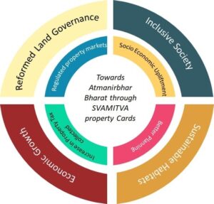
About SVAMITVA Scheme & Global Outreach:● Full Form: Survey of Villages and Mapping with Improvised Technology in Village Areas. ● Launched By: Ministry of Panchayati Raj, April 2020. ● Objective: Provide record of rights to rural property owners using drone surveys and modern technology. ● Implementing Agency: Survey of India in collaboration with State Panchayati Raj Departments. ● Benefits: ○ Reduces property disputes. ○ Facilitates bank loans using property as collateral. ○ Boosts digital land records for rural India. ● Global Collaborations: ○ MoUs signed: Russia, Nigeria. ○ Six more in progress with other countries. ○ Recognised as a replicable governance model internationally. |