India's No.1 PU & Degree With Integrated IAS & IPS(UPSC/PSC) Training College.


UN Map Raises Questions Over India Border Depictions
UN MAP RAISES QUESTIONS OVER INDIA’S BORDER DEPICTIONS
WHY IN NEWS ?
A UN world map prepared during consultations on the India-backed “Correct the Map” resolution has depicted Arunachal Pradesh and Aksai Chin between Indian and Chinese claim lines.India maintains these territories as part of its sovereign territory, raising concerns over the map’s cartographic representation.
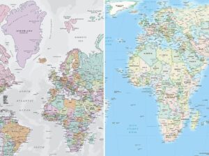
UN MAP AND INDIA’S BORDER CONCERNS:
- Arunachal Depiction: The July 2026 UN map indicates both Indian and Chinese lines around Arunachal Pradesh, while omitting its border with Nagaland.
- Aksai Chin: The map similarly presents parts of Aksai Chin between lines attributed to India and China, despite India’s official position regarding the territory.
- LoC Reference: Jammu and Kashmir is shown with a dotted Line of Control (LoC), accompanied by an explicit note stating that its final status remains unresolved between India and Pakistan.
- Missing Explanation: Unlike the LoC, the map does not provide an explanatory note regarding the Indian and Chinese claim lines around Arunachal Pradesh and Aksai Chin.
- Non-Binding Nature: The UN map is non-binding and does not determine territorial sovereignty, although its use by international and multilateral institutions gives its representation wider significance.
INDIA’S RESPONSE AND CARTOGRAPHIC DIPLOMACY
- India’s Position: The Ministry of External Affairs (MEA) reiterated that India supports accurate representation of its sovereign territory according to its official map.
- Resolution Support: India voted for the “Correct the Map” resolution, but clarified that its vote concerned the principle of equal-area cartographic representation, not endorsement of any particular map.
- Sovereignty Principle: India stated that territories including Jammu and Kashmir and Ladakh must be depicted according to India’s official position and that misleading representations are unacceptable.
- African Initiative: The process began with the African Union’s support for the Equal Earth projection, described as promoting “cognitive justice” by improving Africa’s cartographic representation.
- Other Border Issue: The map appears to reflect Indian control over Kalapani–Lipulekh–Limpiyadhura, an area also claimed by Nepal, illustrating the complexity of international cartography.
ABOUT INDIA’S BORDER DISPUTES:● China Dispute: India and China have unresolved boundary differences involving Arunachal Pradesh and Aksai Chin, forming part of the broader India-China boundary question. ● LAC Context: The Line of Actual Control (LAC) broadly separates areas under Indian and Chinese control, though it is not a mutually agreed international boundary. ● Pakistan Dispute: The LoC separates Indian- and Pakistan-administered areas of Jammu and Kashmir and emerged from military agreements following conflicts between the two countries. ● Nepal Dispute: Kalapani, Lipulekh and Limpiyadhura remain contested between India and Nepal, reflecting differing interpretations of the historical boundary. ● Cartographic Sovereignty: Maps are important instruments of territorial representation and diplomacy, but international maps or UN cartography do not by themselves legally determine sovereignty or boundaries. |