Mount Lewotobi Erupts, Disrupts Indonesia Flights
Indonesia’s Mount Lewotobi Erupts, Disrupts Air Travel
Why in the News?
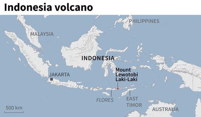
Mount Lewotobi Laki-Laki, located in East Nusa Tenggara, erupted again, releasing a massive volcanic ash cloud. The Indonesian government raised the disaster alert to the highest level, leading to village evacuations and cancelled flights across international routes due to safety risks. The volcanic eruption has particularly impacted Bali, a popular tourist island, causing significant disruptions to air travel, with many Bali flights cancelled.
Eruption Details and Government Response:
- Mount Lewotobi Laki-Laki, a 1,584m-high volcano on Flores Island, erupted on Wednesday. The volcano, part of a twin volcano system, spewed a colossal ash plume into the sky.
- The volcano released a massive ash column visible from nearby villages like Talibura in Sikka district. The hot ash column reached several kilometers high, forming a mushroom-shaped cloud characteristic of a significant volcanic event.
- Authorities raised the volcanic alert level to 4, the highest alert level in Indonesia’s four-tiered system.
- The Indonesian government ordered the evacuation of several nearby villages as a precautionary measure. The disaster mitigation agency (BNPB) has established evacuation sites and safe locations for affected residents, implementing a strict exclusion zone around the volcano’s crater.
Impact on Air Travel
- Volcanic ash, which can damage aircraft engines, caused significant disruption in air services, with numerous international flights affected.
- Bali’s main airport, Denpasar International Airport, reported the cancellation of dozens of flights, including AirAsia flights and connections to Australia, Malaysia, India, and China.
- Airlines took precautionary steps to avoid ash clouds, ensuring passenger safety. Qantas Airways and Virgin Australia were among the carriers that adjusted their schedules due to the ongoing volcanic activity and presence of ash plumes.
- The volcanic ash cloud has also impacted flights to Labuan Bajo, a popular tourist destination near Komodo National Park.
Regional and Environmental Concerns
- Indonesia lies on the Ring of Fire, making it prone to volcanic activity and seismic activity due to the movement of tectonic plates along seismic fault lines.
- Mount Lewotobi’s renewed eruption highlights the environmental vulnerability of tourist-heavy zones like Flores and nearby areas such as Komodo National Park.
- The eruption has raised concerns over disaster preparedness and emergency response mechanisms in remote volcanic regions. Local authorities are advising residents to use face masks to protect against ash rain.
- Authorities are monitoring for potential secondary hazards such as lahar floods or debris flow, which can occur following a volcanic eruption and the displacement of volcanic materials.
About Mount Lewotobi Laki-Laki and Indonesia – Key FactsMount Lewotobi Laki-Laki● Type: Stratovolcano; part of a twin volcano system with Mount Lewotobi Perempuan (“husband-wife” volcanoes). ● Location: Southeast Flores Island, Indonesia; in the Lesser Sunda Islands volcanic arc. ● Geology: ○ Twin peaks: Laki-laki (more active), Perempuan (less active). ○ Formed by Indo-Australian Plate subducting beneath the Eurasian Plate. ○ Known for frequent eruptions, pyroclastic flows, and ash columns >5 km. About Indonesia● Region: Southeast Asia; between Indian and Pacific Oceans. ● Capital: Jakarta (being moved to Nusantara). ● Borders: Malaysia, Papua New Guinea, Timor-Leste. ● Islands: Over 17,000 islands; major ones: Java, Sumatra, Borneo, Sulawesi, Papua. ● Volcanoes: 100+ active volcanoes; part of Ring of Fire. ● Rivers: Longest is Kapuas (1,140 km). ● Tectonics: Located at the Indo-Australian, Eurasian, and Pacific plate junction – highly seismic. |