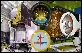
NavIC Setbacks: Atomic Clock Failure
NavIC Faces Setbacks As Atomic Clock Failure Emerges
Why in the News ?
India’s regional navigation system NavIC faces fresh concerns after an atomic clock failure in one of its satellites. Combined with earlier satellite issues and delays, this raises questions about the reliability and progress of India’s indigenous GPS alternative.
Recent Issues Affecting NavIC System:
- Indian Space Research Organisation reported failure of an atomic clock onboard IRNSS-1F satellite.
- Atomic clocks are crucial for accurate positioning and navigation signals.
- The satellite, launched in 2016, has completed its 10-year mission life, contributing to system degradation.
- Earlier satellites like IRNSS-1A have become defunct, while others are nearing end-of-life.
- The recently launched NVS-02 satellite (2025) failed to reach its final orbit due to an electrical malfunction.
- These issues reduce the overall reliability and accuracy of NavIC services.
- Despite setbacks, the satellite continues limited services like one-way messaging.
- Persistent technical failures highlight maintenance and upgrade challenges in the constellation.
Challenges in Developing India’s GPS Alternative
- NavIC has faced technical setbacks since inception, particularly with atomic clock failures.
- Delay in developing the user segment (receivers, chips) limits widespread adoption.
- A 2018 CAG report flagged concerns regarding implementation delays and inefficiencies.
- Compared to global systems like GPS, GLONASS, Galileo, and BeiDou, NavIC remains regional and less mature.
- India relies on external systems for broader navigation needs.
- Frequent discrepancies in satellite performance affect credibility and user trust.
- However, NavIC offers better signal availability in India, especially in urban and difficult terrains.
- Expansion and stability are key for achieving strategic autonomy in navigation.
About NavIC System :● NavIC (Navigation with Indian Constellation) is India’s regional navigation satellite system. ● Developed by ISRO under the IRNSS programme. ● Covers India and up to 1500 km beyond its borders. ● Designed constellation: 7 satellites (plus replacements). ● Provides positioning accuracy of ~10 metres over India. ● Uses three frequency bands (L5, S, and L1) for improved interoperability. ● Applications: navigation (land, air, sea), disaster management, mapping, and defence. ● New-generation satellites feature indigenous atomic clocks and longer lifespan (12 years). ● Strategic importance: reduces dependence on foreign navigation systems and enhances national security. |