NAKSHA Programme: Transforming Urban Land Records with Geospatial Technology
Why in the news?
The Union Minister of Rural Development and Agriculture & Farmers’ Welfare launched the NAKSHA programme in Raisen, Madhya Pradesh. This initiative leverages geospatial technology to modernize urban land records, ensuring accuracy, transparency, and efficiency in property documentation.
Key points: NAKSHA Programme
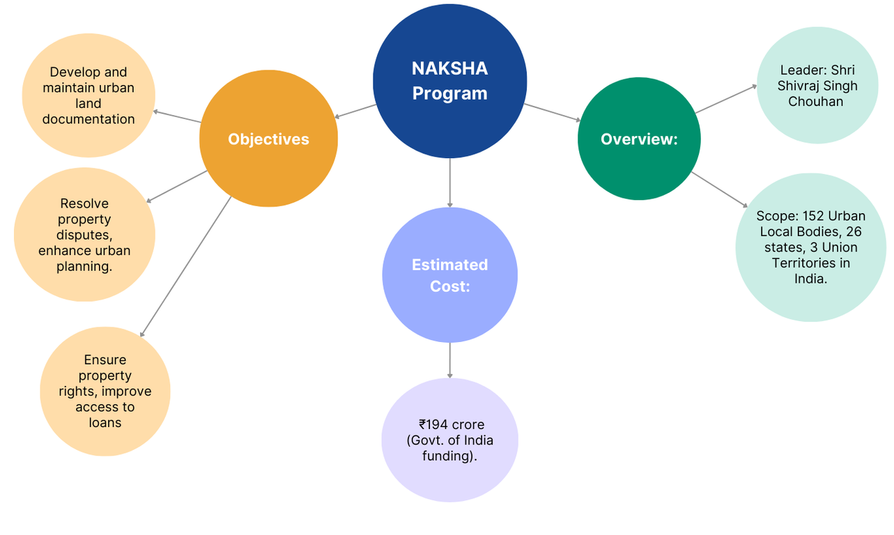
- The National Geospatial Knowledge-based Land Survey of Urban Habitations (NAKSHA) was launched by the Union Minister of Rural Development and Agriculture & Farmers’ Welfare in Raisen, Madhya Pradesh.
- It aims to modernize urban land records using advanced geospatial technology for accuracy, transparency, and efficiency in property ownership documentation.
- The initiative will help in reducing land disputes, enhancing ease of living, and improving urban planning.
Key Features and Implementation
- The programme introduces an IT-based property record system to improve efficiency and support sustainable urban development.
- Survey of India is the technical partner, responsible for conducting aerial surveys and orthorectified imagery.
- It collaborates with third-party vendors and state governments to implement the project effectively.
- Madhya Pradesh State Electronic Development Corporation is developing a web-based GIS platform, while National Informatics Centre Services Incorporated (NICSI) ensures secure data storage.
Impact and Future Prospects
- State and Union Territory governments will be responsible for on-ground execution.
- The programme is expected to streamline property ownership records, improve land governance, and boost investment in the real estate sector.
- By integrating technology-driven land mapping, NAKSHA sets a new benchmark in urban land management across India.