THE ANDAMAN AND NICOBAR ISLAND
About Andaman And Nicobar Island: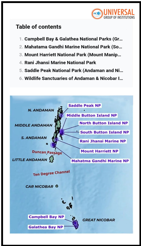
History:
Early Colonial Era and Japanese Occupation
- Established as a British penal colony post-1857 War of Independence for Indian revolutionaries.
- Occupied by the Japanese during World War II (1942), later liberated by Netaji Subhas Chandra Bose in 1943.
- Returned to British control after Japanese surrender in 1945, transferred to India on the eve of Independence.
Post-Independence :
- Naval garrison established in 1962 amid security concerns, notably involving a Chinese submarine.
- Andaman Nicobar Command (ANC) formed in 2001 post-Kargil War, integrating forces across all services and the Coast Guard.
Geographical Features
- Ten Degree Channel: Strait separating Andaman and Nicobar Islands at approximately 10 degrees latitude.
- Indira Point: Southernmost tip of the Nicobar Islands, located on Great Nicobar Island, marking India’s southernmost point.
Cultural and Tribal Diversity
- Home to 5 Particularly Vulnerable Tribal Groups (PVTGs): Great Andamanese, Jarwas, Onges, Shompens, and North Sentinelese.
- These groups contribute to the cultural richness and biodiversity of the Andaman and Nicobar archipelago.
Strategic Location of the Andaman and Nicobar Islands
|