
Annual Flood Crisis: North Bihar’s Ongoing Struggles
Why in the news?
North Bihar faces severe flooding annually, affecting over 15 lakh people, with geographic vulnerabilities and inadequate infrastructure exacerbating the situation amidst heavy rainfall and sedimentation issues.
Flood Impact in North Bihar
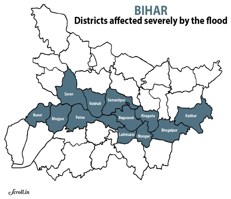
- Approximately 76 lakh people are affected in 17 districts due to ongoing floods.
- North Bihar is described as “India’s most flood-prone” region, with 76% of its population living under the threat of flooding.
- The state experiences flash floods, river floods, drainage congestion floods, and permanent waterlogging.
Geographic Vulnerability
- North Bihar’s location south of Nepal makes it susceptible to flooding from Himalayan rivers carrying sediment.
- Snow and rain-fed rivers, including Kosi, Gandak, and Bagmati, overflow easily, exacerbating flood conditions.
- Permanent waterlogging results from silted rivers, encroachment, and local topography (Chaurs), which complicates flood management efforts.
Issues with Infrastructure and Solutions
- The Kosi River, known as the “Sorrow of Bihar,” has seen repeated breaches of embankments built in the 1950s, leading to severe flooding.
- Despite structural solutions like dams and embankments, the river’s sedimentation has made flooding more likely.
- Experts advocate for a dual approach combining structural (dams, embankments) and non-structural solutions (laws, policy, risk reduction) to manage floods effectively.
Reasons for Bihar’s Flood Vulnerability:
- Geographic Factors:
- 76% of North Bihar’s population lives under flood threat.
- Crisscrossed by snow-fed and rain-fed rivers, leading to various flood types.
- Types of Floods:
- Flash Floods: 8-hour lead time from rainfall in Nepal.
- River Floods: 24-hour lead time; can take weeks to recede.
- Drainage Congestion: Lasts the monsoon season; takes up to 3 months to recede.
- Permanent Waterlogging: Caused by silted rivers and drainage encroachments.
- Economic Impact and Solutions:
- Economic losses from crop, infrastructure, and livestock damage; Rs 1,000 crore spent annually on flood management.
- Proposed solutions include new barrages and a dual approach: structural (dams) and non-structural (policies and awareness).
Solutions for Flood Management in India:
Structural Measures:
- InterLinking of Rivers (ILR): Connects surplus rivers to deficient ones; e.g., Ken-Betwa project.
- Reservoirs: Stores excess water; e.g., Bhakra Nangal Dam for flood control and irrigation.
- Coastal Flood Management: MISHTI Initiative for mangrove plantation to mitigate coastal flooding.
- Embankments: Raised structures that confine water flow and protect adjacent areas.
- Diversions: Redirects water to less vulnerable areas; e.g., Indira Gandhi Canal project for irrigation.
Non-Structural Measures
- Flood Forecasting and Early Warning: Central Water Commission issues daily flood alerts.
- Flood Plain Zoning: Regulates land use in flood-prone areas per NDMA guidelines.
- Flood Insurance: Provides financial compensation for flood losses; e.g., PMFBY for crop insurance.
- Flood Awareness: NDMA conducts campaigns to enhance community preparedness and resilience.
Sources Referred:
PIB, The Hindu, Indian Express, Hindustan Times


